|
|
|||||||
23 November 2006 CUHK Yuen Yuen Research Centre for Satellite Remote Sensing
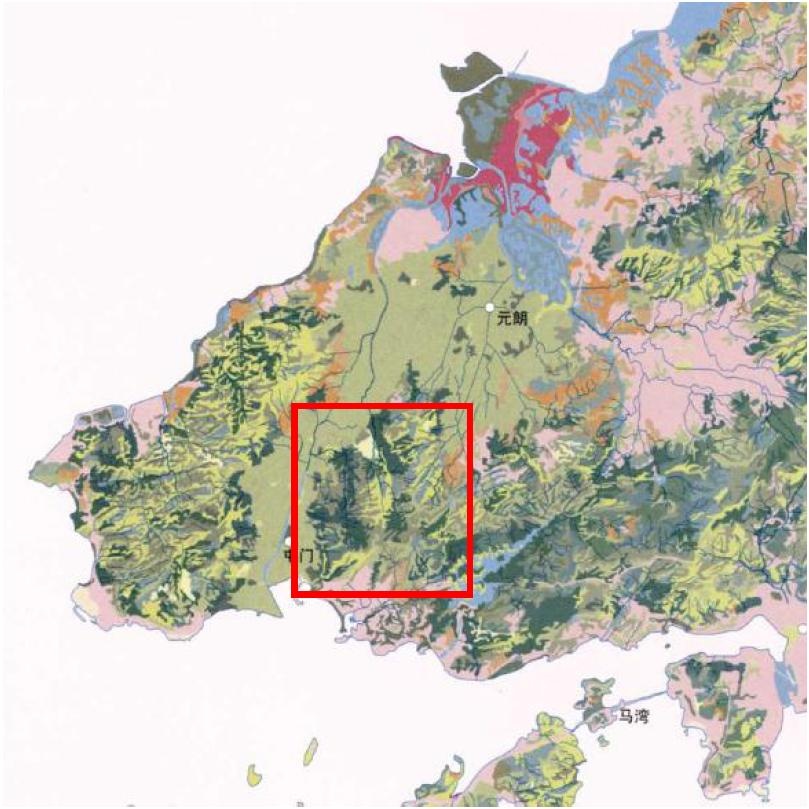
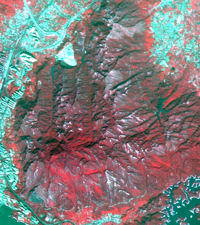
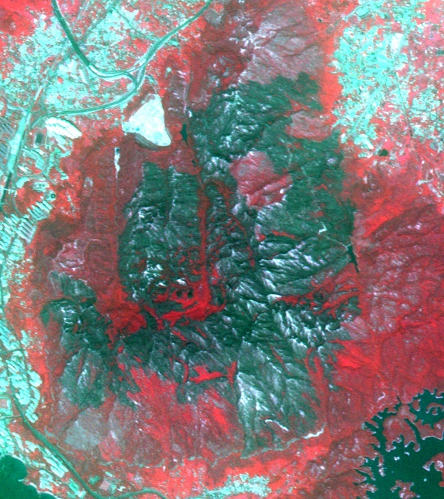
Researchers compared satellite picture of the country park at 17 December 2005 (before the hillfire) with that taken at 12 November 2006 (after the hillfire) and delineated the area of destruction (red area representing vegetation and black area is the blazed area). Preliminary computer analysis showed that the hillfire resulted in great-area destruction of 740 hectares. (see note)
The Yuen Yuen Research Centre for Satellite Remote Sensing The Yuen Yuen Research Centre for Satellite Remote Sensing was established in March 2004 by The Chinese University of Hong Kong with a generous donation from the Yuen Yuen Institute. The Research Centre is dedicated to promote and advance remote sensing research and applications for the benefits of the community. Besides, the Centre is also committed to research in applications of remote sensing science in agriculture, natural resource management, seashore and ocean environment, emergencies, monitoring and management of natural hazards, health and environment with particular focus on Hong Kong and the Southern China. The Research Centre also cooperates with the governments, universities and research institutes around the world in promoting information and academic exchange. |
|||||||